MANTIS Ph.D. Students Present Research at ASBPA - Galveston, TX

MANTIS Ph.D. candidate Isabel Garcia-Williams and Ololade Esther Oladoyin recently presented their research at the American Shore and Beach Preservation Association (ASBPA) Conference, held from August 26 to 29 in Galveston, Texas. This year's conference, themed "Wrangling the Waves of Change: Adapting to Coastal Dynamics," brought together experts, researchers, and students to address the challenges facing coastal environments.

The conference provided a platform for both students to receive valuable feedback from leading experts, further refining their research. Their participation underscored the critical role that emerging scholars play in advancing sustainable coastal management practices.

Isabel Garcia-Williams Publishes Article in Agrosystems, Geosciences & Environment

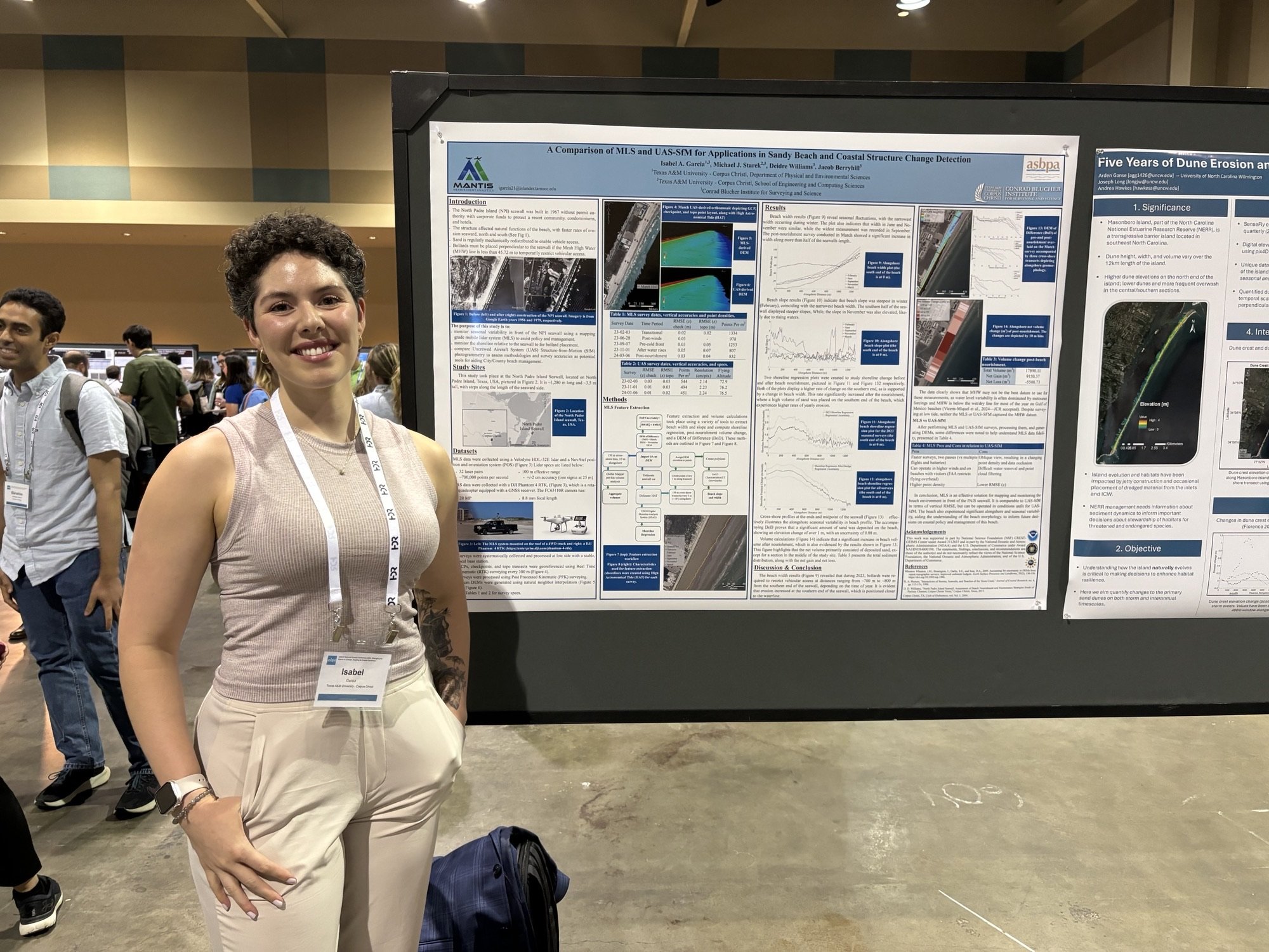
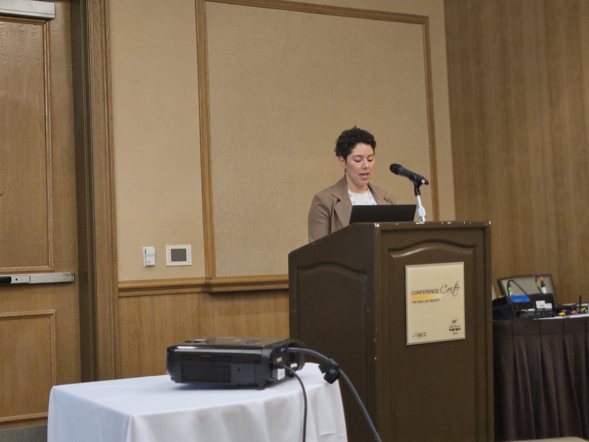
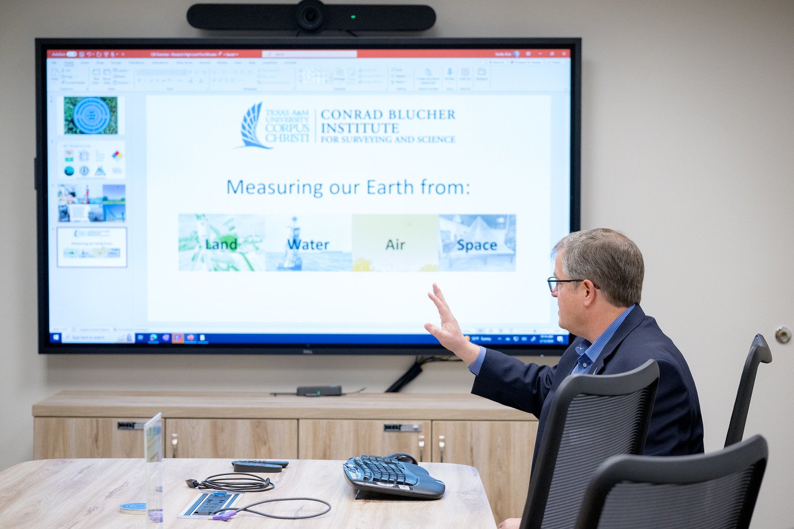
MANTIS Ph.D. Candidate Isabel Garcia-Williams has recently published an article in Agrosystems, Geosciences & Environment titled "UAS-Based Multispectral Imaging for Detecting Iron Chlorosis in Grain Sorghum”. The article focuses on utilizing a small uncrewed aircraft system (UAS) equipped with a multispectral sensor to assess various vegetation indices (VIs) for their potential to monitor iron deficiency chlorosis (IDC) in grain sorghum (Sorghum bicolor L.).

——

The abstract reads as follows:

This study uses a small unmanned aircraft system equipped with a multispectral sensor to assess various vegetation indices (VIs) for their potential to monitor iron deficiency chlorosis (IDC) in a grain sorghum (Sorghum bicolor L.) crop. IDC is a nutritional disorder that stunts a plants’ growth and causes its leaves to yellow due to an iron deficit. The objective of this project is to find the best VI to detect and monitor IDC. A series of flights were completed over the course of the growing season and processed using Structure-from-Motion photogrammetry to create orthorectified, multispectral reflectance maps in the red, green, red-edge, and near-infrared wavelengths. Ground data collection methods were used to analyze stress, chlorophyll levels, and grain yield, correlating them to the multispectral imagery for ground control and precise crop examination. The reflectance maps and soil-removed reflectance maps were used to calculate 25 VIs whose separability was then calculated using a two-class distance measure, determining which contained the largest separation between the pixels representing IDC and healthy vegetation. The field-acquired data were used to conclude which VIs achieved the best results for the dataset as a whole and at each level of IDC (low, moderate, and severe). It was concluded that the MERIS terrestrial chlorophyll index, normalized difference red-edge, and normalized green (NG) indices achieved the highest amount of separation between plants with IDC and healthy vegetation, with the NG reaching the highest levels of separability for both soil-included and soil-removed VIs.

——

This publication marks a significant milestone in Garcia-Williams' academic career, highlighting her as a prominent researcher and leading voice in the intersection of technology and agriculture.

For more information, visit the full article at Agrosystems, Geosciences & Environment.

MANTIS PhD Students Present Research at IGARSS - Athens, Greece

MANTIS Ph.D. students José Pilartes-Congo and Benjamin Gansah recently attended the 2024 IEEE Geoscience and Remote Sensing Symposium in Athens, Greece (July 7-12). The symposium provided a fantastic opportunity for the students to network with leading experts and emerging scholars in the realm of geosciences and remote sensing.

Jose Pilartes-Congo presented two manuscripts that explore the applications of UAS-based technologies for surveying and mapping. The first manuscript, titled “Examination of UAS-SfM and UAS-Lidar for Survey Repeatability of Roadway Corridors”, delves into the reliability and precision of using UAS-Structure from Motion (SfM) and UAS-Lidar for repeat surveys of roadway corridors. Pilartes-Congo’s findings highlight the potential for these technologies to revolutionize infrastructure monitoring and maintenance, offering cost-effective and efficient alternatives to traditional surveying methods. The second manuscript, titled “SfM-MVS Photogrammetry with UAS: Leveraging Image Segmentation for Efficient Mapping in Dynamic Coastal Zones”, which he presented on behalf of Dr. Pashaei (MANTIS post-doctoral fellow) explores the integration of deep learning and image segmentation techniques with SfM-Multi-View Stereo (MVS) photogrammetry to enhance mapping accuracy in dynamic coastal environments. The research underscores the importance of advanced computer techniques to enhance the quality of UAS-derived 3D point clouds.

Gansah’s manuscript “Utilizing UAS-Lidar for High Throughput Phenotyping of Energy Cane” focuses on the deployment of UAS-Lidar systems for the high throughput phenotyping of energy cane, a key bioenergy crop. His research demonstrates how UAS-Lidar can provide precise, large-scale measurements of plant traits, thereby enhancing crop productivity and monitoring.

The 2024 IEEE Geoscience and Remote Sensing Symposium continues to serve as a vital platform for fostering collaboration, sharing knowledge, and inspiring the next generation of researchers in the field. As the symposium concludes, Pilartes-Congo and Gansah leave with a completely different vision of the future of remote sensing and geosciences and look forward to implementing some of the knowledge they acquired to progress their own research.

José Pilartes-Congo Presents Research on Reality Capture Technologies in Transportation

José Pilartes-Congo, MANTIS Ph.D. student, recently attended and presented his research at the Utility Engineering and Surveying Institute (UESI) conference, held at Oregon State University in Corvallis, Oregon. His presentation, titled "Evaluation of UAS Survey Repeatability for Surface Modeling and Change Detection of Roadway Corridors," showcased the team’s contributions in the field of geospatial technology for transportation applications.

The UESI conference provided an invaluable opportunity for José, who was thrilled to engage with experts and receive constructive feedback that will undoubtedly enhance his research. The experience also offered him vital presentation practice in anticipation of his upcoming proposal defense.

Adding to the prestige of the event, José was awarded the Surveying Conference Student Scholarship. This scholarship aims to reduce the financial burden of conference attendance and connects recipients with professionals in surveying and mapping, maximizing the educational and networking benefits of the conference.

As José prepares for his proposal defense, the knowledge and experience gained at the UESI conference will undoubtedly play a crucial role in his continued academic success.

Klein Collins High School Visits MANTIS Ahead of Skills USA Competition

A group of eager students from Klein Collins High School (Spring, Texas) recently visited the Measurement Analytics Laboratory to learn about career opportunities in the geospatial sector, particularly about Remote Sensing applications. The students were excited to see how the MANTIS team transforms raw field data into practical products that help in areas such as agriculture, topographic mapping, and disaster management.

The learning didn't stop there. The very next day, Klein Collins students were part of a group of 39 students who took part in the SkillsUSA Texas Land Surveying Competition at Texas A&M University-Corpus Christi, hosted by the Conrad Blucher Institute. Our very own MANTIS student José Pilartes-Congo generously gave his time to volunteer at the event.

This year’s competition winners were:

  • 1st Place: Dubiski Career High School

  • 2nd Place: Klein Collins High School

  • 3rd Place: YISD Career and Technical Center

MANTIS Presents Remote Sensing Career Opportunities to South Side High School

MANTIS Director Dr. Michael J. Starek recently led a captivating talk with Southside High School (San Antonio) students. The purpose of the talk was to ignite interest in Geospatial Science and Engineering among students. Focusing on Remote Sensing, Starek shed light on the diverse applications and opportunities within the field. Through interactive discussions and presentations, students gained insights into technologies such as drones, lidar, and thermal imagery, learning how they're utilized to gather crucial data about the Earth's surface without direct contact.

The event emphasized the interdisciplinary nature of Geospatial Science, showcasing its intersections with Geography, Computer Science, Environmental Studies, and Archeology. Students were encouraged to explore diverse career paths within the field, inspired by the real-world projects presented by the MANTIS team.

Texas Transportation Institute's Leadership Visits with CBI/MANTIS

MANTIS Director, Dr. Michael J. Starek, and Associate Director, Dr. Tianxing Chu, were among the attendees as the Conrad Blucher Institute (CBI) held talks with representatives from the Texas Transportation Institute (TTI) in a collaborative effort to advance transportation initiatives (i.e., movement of people, data, and goods).

The CBI personnel was joined by Mr. Gregory D. Winfree and Dr. Joe Zietsman from TTI. Mr. Gregory D. Winfree, Agency Director of TTI, brought a wealth of experience to the table, having served in various capacities within the transportation sector. As an Adjunct Professor at the Texas A&M University School of Law and a member of the Texas Connected and Automated Vehicle Task Force, Winfree's expertise aligns with the goals of fostering innovation and efficiency in transportation systems. Dr. Joe Zietsman, Deputy Agency Director and Strategic Advisor at TTI, boasts a distinguished career marked by significant contributions to transportation research. With over 30 years of experience, Dr. Zietsman has spearheaded numerous projects focusing on transportation planning, sustainability, and air quality. His visionary leadership has led to the establishment of groundbreaking initiatives, including a pioneering emissions testing facility.

Isabel Garcia-Williams Presents Research on Sea Turtle Habitat Mapping at ASPRS Conference

MANTIS Ph.D. candidate, Isabel Garcia-Williams, showcased her research at the American Society for Photogrammetry and Remote Sensing (ASPRS) conference held in Denver, Colorado (February 2024 edition). The conference, known for its cutting-edge advancements in geospatial technologies, provided the perfect platform for Isabel to unveil her innovative study titled "Mapping Vulnerability of Kemp’s Ridley Sea Turtle Nesting Habitat on Padre Island National Seashore, Texas using a Miniaturized Mobile Lidar System."

Her research focuses on utilizing a miniaturized mobile lidar system to map the nesting habitat of Kemp’s Ridley sea turtles on Padre Island National Seashore, southern Texas. This approach represents a crucial advancement in conservation efforts for this endangered species.

The miniaturized mobile lidar system employed in Garcia-Williams's research allows for highly detailed 3D mapping of the nesting grounds, providing invaluable data for conservationists and policymakers. By accurately identifying and assessing the vulnerability of these habitats, interested parties can implement targeted conservation strategies to mitigate threats and ensure the long-term survival of Kemp’s Ridley sea turtle population.

MANTIS Students in Attendance as Topographic Inc. Visits CBI

MANTIS students joined the discussion as Topographic Inc., a surveying firm with offices across the nation, visited the Conrad Blucher to discuss career opportunities for students in the geospatial industry. Over the years, Topographic has been instrumental in fostering opportunities for GISc students at TAMUCC, offering internships and financial aid for undergraduates participating in the NSPS Student Competition.

Dr. Pashei Promoted to CBI Research Scientist.

Dr. Mohammad Pashaei has been promoted to Research Scientist at the Conrad Blucher Institute for Surveying and Science (CBI) at Texas A&M University-Corpus Christi.

He will continue his work as part of CBI’s MANTIS Lab, complementing and expanding research strengths of the lab and advancing CBI’s mission. As a Research Scientist, he will support project deliverables through research and technical report writing, serve as a principal investigator or co-investigator on research projects, and supervise and mentor employees and student researchers, among other tasks.

MANTIS Lab Featured by the ASPRS - Gulf Chapter

The MANTIS Lab is making waves in the geospatial community, with its innovative research on Unmanned Aerial Systems (UAS) and Structure-from-Motion (SfM) / Lidar technology recently featured in an article by the American Society for Photogrammetry and Remote Sensing (ASPRS) Gulf Chapter. The article highlights the lab's ongoing collaboration with the Texas Department of Transportation (TxDOT) on a project utilizing UAS-SfM/Lidar technology to support a variety of land surveying applications. This cutting-edge approach promises to revolutionize the way TxDOT assesses and maintains the state's vast transportation network.

This recognition from the ASPRS Gulf Chapter is a testament to the dedication and expertise of MANTIS and its commitment to pushing the boundaries of UAS-SfM/Lidar technology and making a real difference in the field of infrastructure inspection and monitoring.

Representatives from the Texas A&M University System National Laboratories Office Visit MANTIS

In a notable recent occurrence, delegates from the Texas A&M University System National Laboratories paid a visit to the MANTIS Laboratory. This brief yet insightful encounter featured the presence of Dr. Arnold Muyshondt, the Assistant Vice Chancellor for National Laboratories, and Evelyn Mullen, who serves as the Special Advisor to the Vice Chancellor for Research at TAMUS.

During this visit, the distinguished guests engaged with the dedicated team of researchers and students at MANTIS, gaining valuable insights into their ongoing research endeavors and the diverse applications of remote sensing in the realm of geospatial science/engineering. This informative exchange served to foster a deeper understanding of the groundbreaking work taking place at MANTIS and its potential to advance the field of geospatial research.

Xiaojun Qiao Defends Dissertation

MANTIS Ph.D. Student Xiaojun Qiao successfully defended his dissertation titled Assessment of Land Subsidence Along the Texas Gulf Coast. After several publications and presentations, Xiaojun now joins a prestigious list to have successfully gone through the Geospatial Computer Science doctoral program at Texas A&M University-Corpus Christi.

His presentation abstract read as follows:

The Texas Gulf Coast has been recognized as one of the subsidence hotspots in the United States, thereby presenting risks such as shoreline erosion and coastal flooding. The accurate estimation of subsidence and the identification of its underlying causes hold significant value for comprehending subsidence processes and guiding decision-making. To achieve this, the research integrated space-borne and terrestrial geodetic techniques, utilized multi-source observations, and applied machine learning (ML) methods for the estimation, modeling, and attribution of subsidence along the Texas Gulf Coast. First, two sea-level difference methods were designed to reconstruct displacement time series at tide gauge (TG) locations in Texas with observation periods exceeding ten years. In addition, synthetic aperture radar (SAR) imagery, continuously operating global navigation satellite system (cGNSS) observations, and sea-level measurements were harnessed to estimate the spatiotemporal patterns of subsidence spanning around three decades since the 1990s at the Eagle Point TG station, a prominent hotspot of sea-level rise in the United States. Moreover, the interferometric SAR (InSAR) was leveraged to generate a large-scale subsidence map along the Texas coastlines post-2016. Attribution analysis indicated that hydrocarbon extraction and groundwater withdrawal were the predominant factors responsible for identified subsidence hotspots in the Texas Gulf Coast. ML demonstrated an impressive performance (with an R2 of 0.56) in modeling the observed large-scale subsidence, by incorporating a range of features related to natural terrain variations and anthropogenic activities. Explainable artificial intelligence (XAI) methods provided quantitative estimates of feature contributions of the ML model, and the data-driven results revealed that the digital elevation model (DEM) and anthropogenic factors were contributing features in relation to subsidence.

MANTIS Research Featured in Research & Innovation Report

The Measurement Analytics Laboratory was recently featured in the Research & Innovation Annual Report (2023) of Texas A&M University-Corpus Christi. The feature, titled Integrating UAS Technology to Revolutionize Highway Construction, outlines the work MANTIS has been doing in collaboration with the Texas Department of Transportation (TxDOT) in integrating UAS-SfM and UAS-Lidar to support surveying applications.

José Pilartes-Congo Awarded TSPS Award

In a heartwarming ceremony held at the annual Texas Society of Professionals Surveyors (TSPS) Convention Awards Gala on October 6, 2023, José Pilartes-Congo, a dedicated student of MANTIS, was honored with the prestigious "Student Volunteer of the Year" award. The event celebrated individuals who have made significant contributions to the land surveying profession in the State of Texas. Receiving the "Student Volunteer of the Year" award was a humbling experience for Pilartes-Congo. In his acceptance speech, he emphasized the importance of teamwork and expressed gratitude to the GIS Student Organization and the Conrad Blucher Institute at Texas A&M University-Corpus Christi who, in his words, were instrumental in making this happen.

José Pilartes-Congo Featured in Texas Surveyor Magazine (September Edition)

MANTIS Ph.D. student José Pilartes-Congo was chosen as the Texas Society of Professional Surveyors (TSPS) featured member of the September edition of the Texas Surveyor Magazine. The feature outlined José’s recent research and responsibilities within the MANTIS Laboratory of the Conrad Blucher Institute.

Texas Surveyor Magazine Feature

Click here for article

MANTIS Well-Represented at IGARSS (Pasadena, California - 2023)

MANTIS Director, Dr. Michael Starek, post-doctoral fellow Dr. Mohammad Pashaei, and Ph.D. students Xiaojun Qiao and José Pilartes-Congo represented MANTIS at the 2023 International Geoscience and Remote Sensing Symposium (IGARSS) in Pasadena, California, between 16-21 July, 2023. The IGARSS conference, a globally recognized platform for Earth and geospatial science professionals, witnessed the participation of a record number of students this year. Their involvement underscored the rising interest and importance of remote sensing technology in addressing critical global challenges.

Presentations Titles:

  • Application of Semantic Image Segmentation for Efficient UAS-SfM Mapping

  • Coastal Subsidence Analysis Between Houston and Galveston, Texas, U.S.A.

  • Impact of Different GNSS Solutions on UAS-SfM Vertical Accuracy for Shoreline Mapping

  • Implementation of a ZED 2i Stereo Camera for High-Frequency Shoreline Change and Coastal Elevation Monitoring

As IGARSS 2023 drew to a close, it was evident that MANTIS’ research would continue to advance the frontiers of remote sensing and contribute to our understanding of Earth's complex systems.